
What’s wrong with the proposals?
It won’t solve the traffic congestion at Dartford
Traffic at the Dartford Crossing was given as 140,000 vehicles a day on average during the 2016 consultation, which includes 25,000 HGVs a day. It is forecast to increase to 159,300 vehicles a day by 2025.
HE forecasts that traffic using the Dartford Crossing will reach 159,300 vehicles a day by 2025. They forecast that when the proposed new crossing is open, cross-river traffic will increase by an additional 56,500 vehicles a day, up to 215,200 vehicles a day. Hence, although traffic through the new crossing is expected to carry 78,500 vehicles a day, traffic using Dartford will still be 136,700 a day, just 14% less than it is forecast to be without the new crossing.
The actual ‘share’ is that 64% of this new, increased volume of traffic is expected to continue to use Dartford, while 36% will use the new crossing.
The capacity at the existing Dartford Crossing is only 135,000 vehicles a day. This is defined as the level at which congestion would be expected to occur in peak periods.
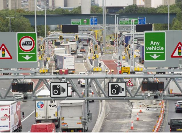
At the time of the consultation, traffic at the Dartford Tunnels was interrupted on average 800 to 900 times a week to allow petrol tankers and other hazardous loads to be escorted through the tunnels. Each stoppage can last 2 minutes, but full closures of up to 10 minutes are sometimes required.
The stoppages and escorts are required because the tunnels do not meet the required safety standards to allow hazardous loads to travel unescorted through the tunnels with other traffic. There are no plans to remove the tunnel restrictions.
The restrictions at Dartford are consider so significant that the managing director of a local haulage company has started a campaign to Stop the Convoys, sending all oversize and hazardous HGV’s around the M25 clockwise.
Highways England propose to do precisely NOTHING at the existing Dartford crossing other than some short-term measures. We don’t believe the LTC proposals will solve the traffic problems at the Dartford Crossing Traffic is forecast to increase by 7% per year so the noise and pollution caused by traffic congestion in the Dartford and Thurrock areas can only increase proportionately, unless a better solution is found.
A Flawed Consultation?
The consultation offered us a choice of a route through Shorne or a route through Thong Lane. Chalk had no choice. We feel that the choices offered were NOT balanced or reasonable.
The Government Ministers said Option A at Dartford is still on the table, but there were no questions about Option A in the consultation such that we were unable to express support or opposition to Option A.
Highways England made available documentation on their proposals on-line and at a number of public information events. We are concerned that you may have been unable to find out everything you needed to know from the published documentation. We think it is unreasonable to expect you to trawl through the 30 volumes and appendices online to seek vital information, such as route maps.


There were no Public Information Events held in Chalk or Higham, two of the worst-affected areas, although there were two in Maidstone. Emails were also sent to c.250,000 Dart Charge account holders. We feel the majority of people in these groups will not be personally affected by the proposals and that their views have been sought to sway the outcome of the consultation in favour of Option C. We are concerned that these groups have not been adequately informed about the environmental impact of the proposals, such that they can make an informed decision.
We are concerned that older people who are not on-line have not been adequately informed about the proposals.
We are concerned that, for reasons not necessarily in the interests of the general public, a decision on a preferred route has been made by Highways England on behalf of the Government, long before the public consultation opened.
Moving the problem, not solving it
The Dartford Crossing is partially or fully closed over 300 times a year due to incidents, that’s nearly once a day. These incidents are caused by traffic collisions, the escorting of hazardous loads through the outdated tunnels and high winds on the bridge.
And yet, Highways England propose to do precisely NOTHING at the existing Dartford crossing other than some short-term measures.
Traffic volumes are forecast to increase by 7% per year. We therefore believe closures of the Dartford Crossing will continue at at least that rate.
Every time there is an incident at Dartford the only options drivers have currently are:
- wait it out
- use the Blackwall Tunnel
- go the other way round the M25
If drivers are given an alternative means of crossing the Thames they will surely try to use it. This would divert most if not ALL M25 traffic onto the A2 past Gravesend and the A13 past Tilbury.
We do not believe these non-motorway trunk roads have the capacity to cope in these circumstances potentially causing gridlock.
During peak times at the Dartford Crossing, there can be typically 30-45 minute delays northbound causing queues back to junction 3 and sometimes as far as junction 4. These hold-ups will be reduced by only 14% or 6 minutes. This will encourage use of “rat-run” routes throughout north Kent involving the M26, A227, A228, A229, and numerous country lanes as much of the traffic that would normally use the Dartford Crossing tries to access the new Lower Thames Crossing.
We do not believe Highways England have adequately modeled the potential impact on other routes in the event of minor or major incidents at the crossings.

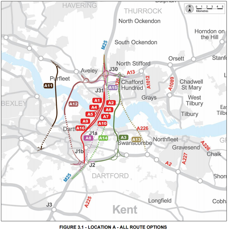
Alternative route for M25 traffic when the Dartford Crossing is congested or closed.

Kent Rat Run Routes (Yellow line shows the preferred route for through freight traffic)
Major housing and London Paramount
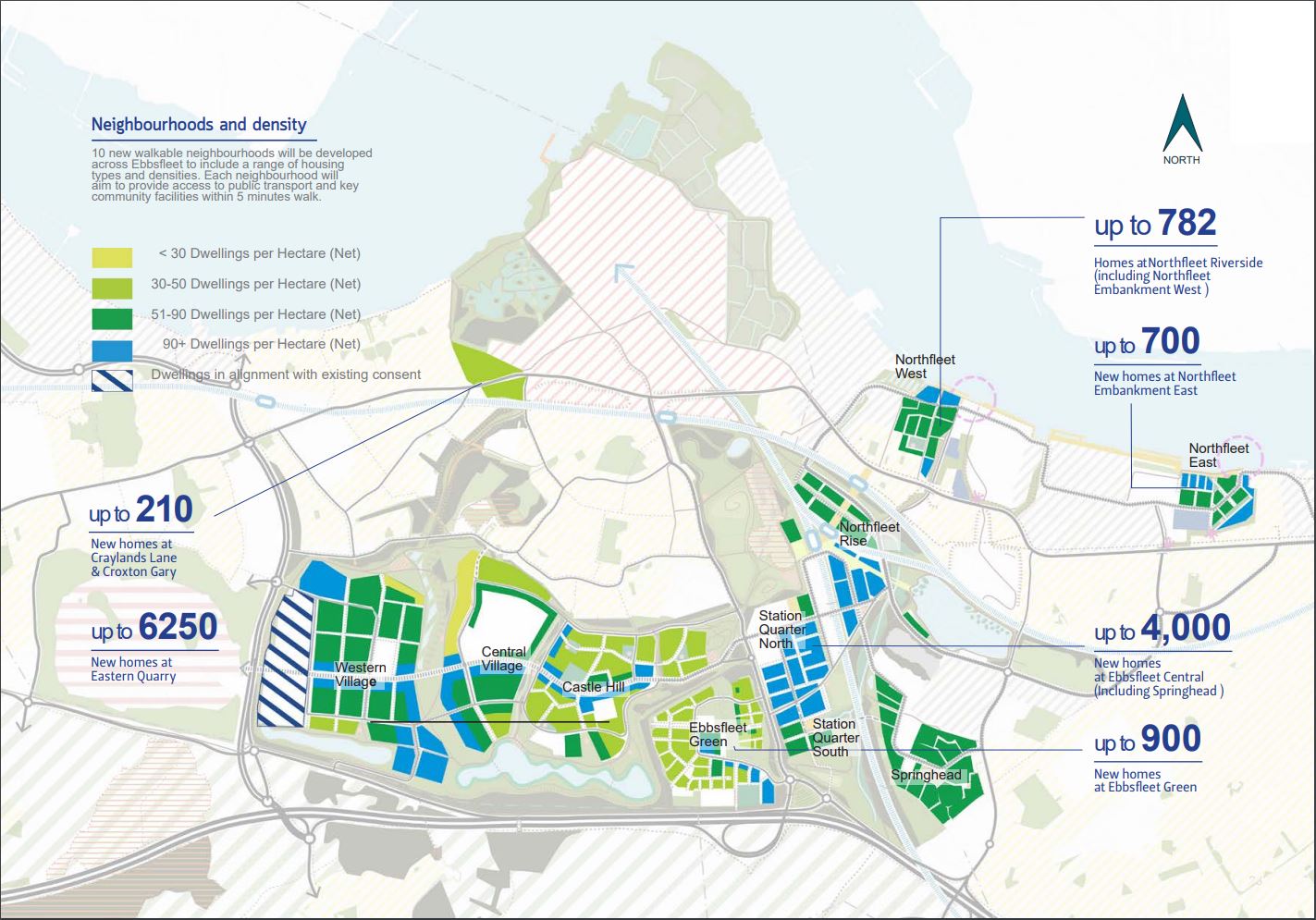
Highways England say they have been unable to consider the effect upon highway demand generated by The London Resort and the Ebbsfleet Garden City housing developments by the Ebbsfleet Development Corporation (EDC).
EDC is aiming to deliver 5,100 homes at Ebbsfleet by 2021. The eventual target is 15,000.
The London Resort, will have been open and running five years before the new Thames crossing is proposed to be completed.
Documents released by London Resort Company Holdings state that they anticipate providing 14,000 car parking spaces. To put that into context Bluewater has 13,000.
The traffic attracted to the new resort is so significant that they proposed to build a major upgrade to the Ebbsfleet junction on the A2 to cater for it.
London Paramount say they will reduce the impact on the roads by developing a comprehensive Travel Management Plan to control visitor and staff flows. Using a chart in their exhibition displays they demonstrate how later opening and closing times will reduce impact upon peak travel hours.
Our concern is that this is not achievable. Typical behaviour of visitors to resorts like this is to cram as much as possible into a day’s visit. Attractions like this are commercially incentivised to operate during opening hours that maximize profit. These two factors have the potential in out view to place up to 14,000 vehicle movements on to the A2, twice a day, coinciding with peak travel hours.
For Highways England to not have included major development related traffic forecasts in their modelling is very concerning indeed.
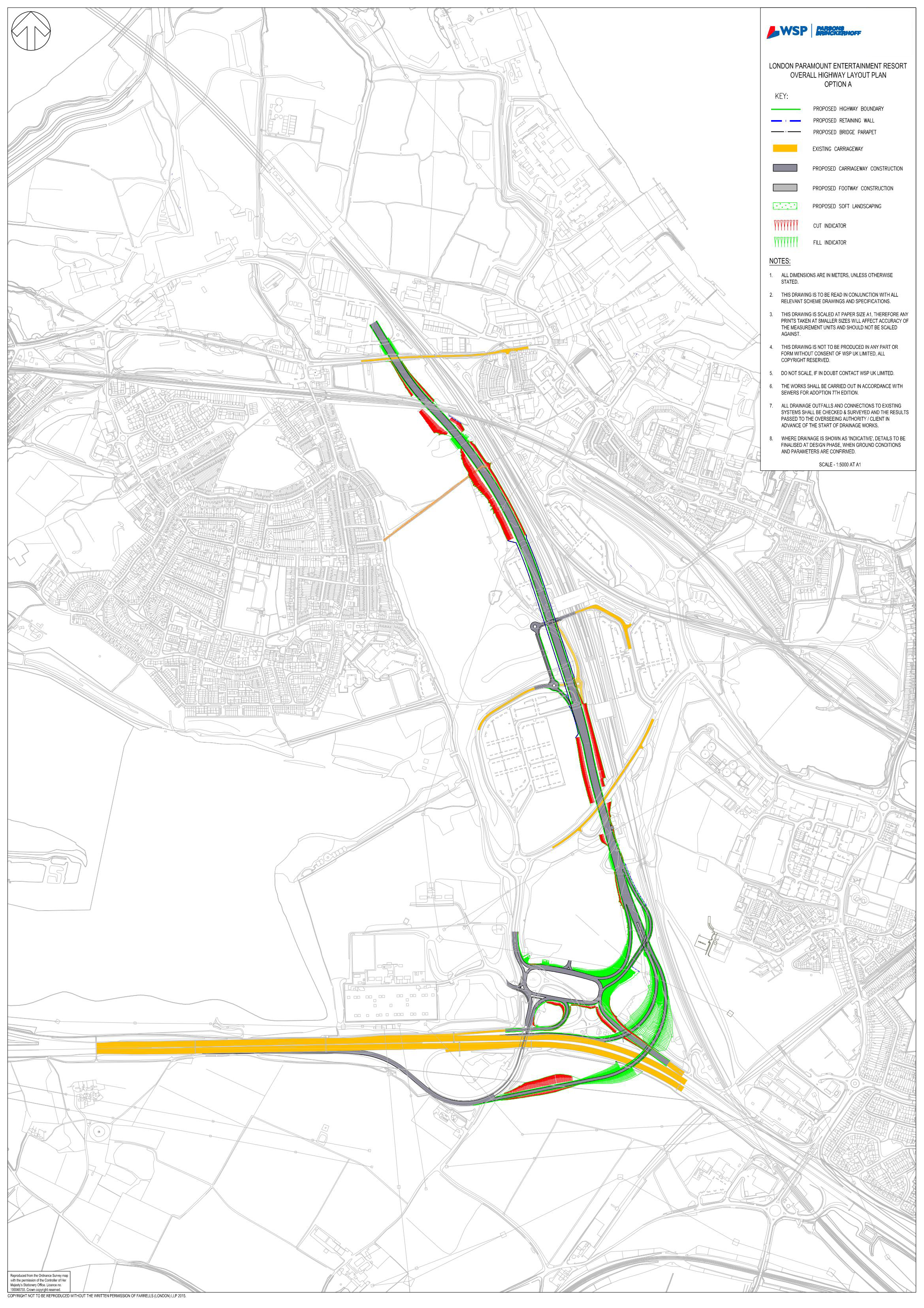
A2 Ebbsfleet junction Option A (c) LRHC
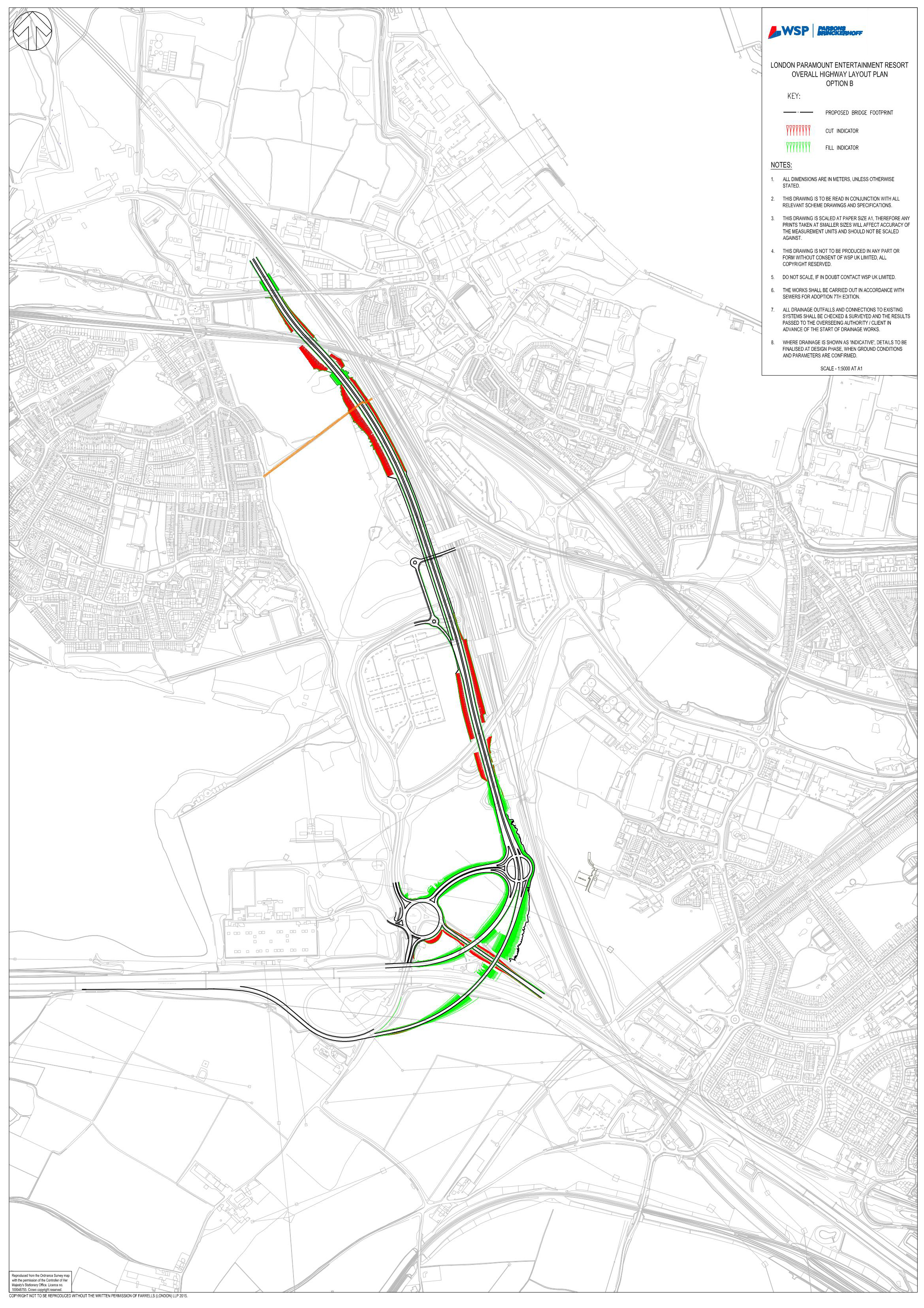
A2 Ebbsfleet junction Option B (c) LRHC

Daily Vehicle Accumulation Profile (c) LRHC
Environmental Devastation
Both proposed ‘Option C’ routes cut through:
- The Kent Downs Area of Outstanding Natural Beauty (AONB),
- Great Crabbles Wood Site of Special Scientific Interest (SSSI),
- Shorne and Ashenbank Woods SSSI,
…all cherished greenbelt land, destroying beautiful and precious countryside forever! Residents across Singlewell, Riverview, Chalk, Shorne, Higham and Strood will be directly affected by increased noise pollution and poorer air quality.
About the Green Belt
In United Kingdom town planning, the green belt is a policy for controlling urban growth. The idea is for a ring of countryside where urbanisation will be resisted for the foreseeable future, maintaining an area where agriculture, forestry and outdoor leisure can be expected to prevail. The fundamental aim of green belt policy is to prevent urban sprawl by keeping land permanently open, and consequently the most important attribute of green belts is their openness.
The Metropolitan Green Belt around London was first proposed by the Greater London Regional Planning Committee in 1935. The Town and Country Planning Act 1947 then allowed local authorities to include green belt proposals in their development plans. In 1955, Minister of Housing Duncan Sandys encouraged local authorities around the country to consider protecting land around their towns and cities by the formal designation of clearly defined green belts.
Wikipedia
Option C cuts right through the Green Belt and prime agricultural land.
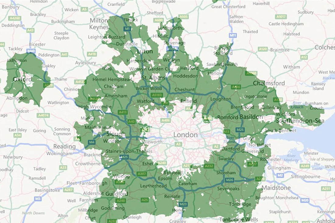
Metropolitan Green Belt
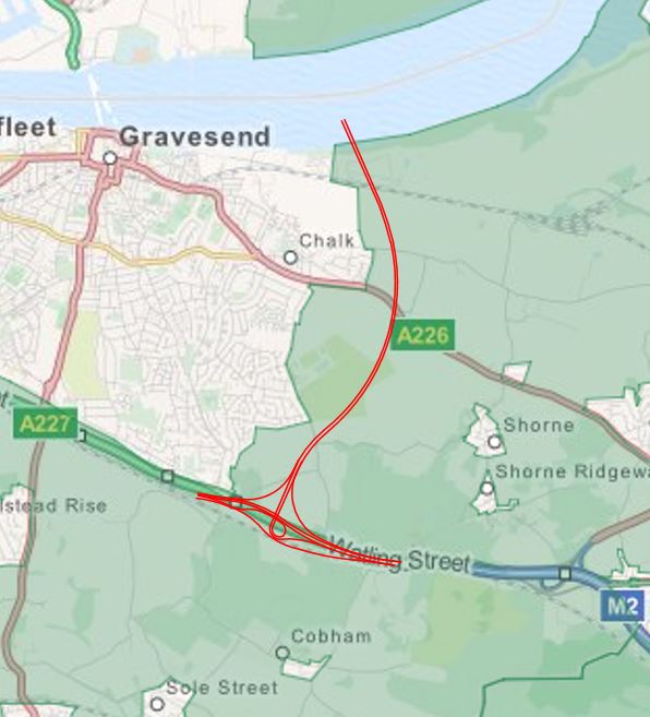
Option C cuts through Green Belt
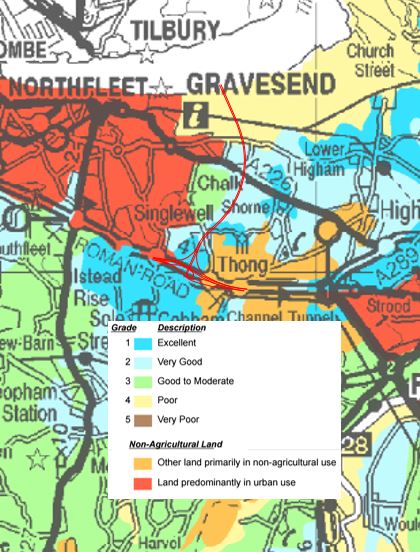
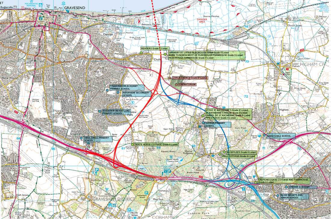
Listed Building, Schools & Churches
This map shows the Western and Easter Southern Link Routes in context with notable sites (only the closest shown for clarity).
Discarding of Options
Highways England discounted at the earliest stage of their investigations routes in the Option A corridor which we believe would better address the traffic congestion problem.
We think Highways England have given too much bias towards their assumptions on “economic benefit” (which means development of housing and business parks).
Representatives of Gravesham Borough Council have stated that there is nothing in the Local Plan for such development within the proposed route corridor through Gravesham.
Therefore we conclude these claimed economic benefits are unfounded, and falsely weight their case for Option C.
It is our considered view that the Option A routes must be reconsidered.

Highways England Technical Appraisal Report Executive Summary, p16